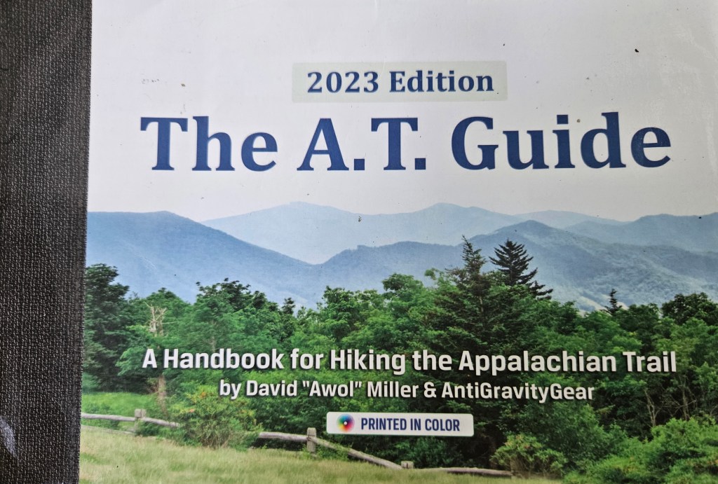
Figured I’d do a little bonus “explainer” post. For the purposes of knowing what’s coming up on trail, there are two options: paper guidebooks and the FarOut app. I use the former.
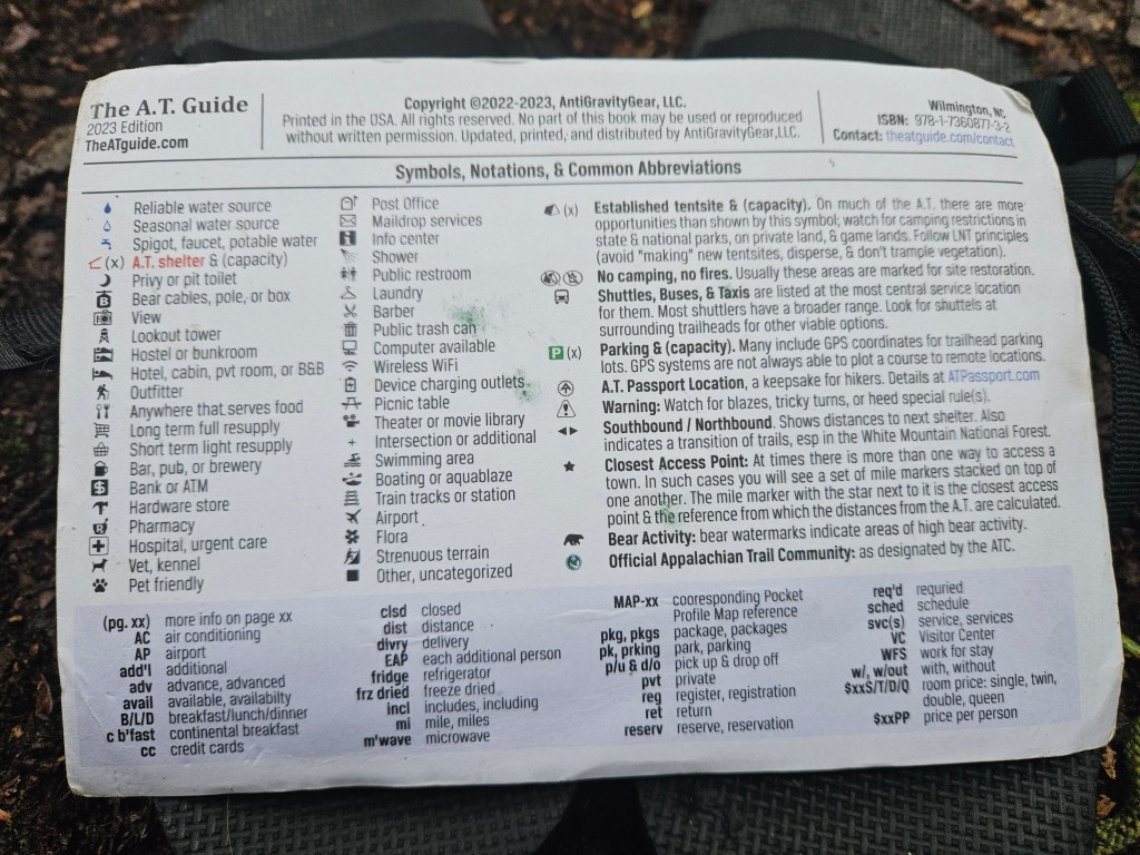
I bought the loose leaf version so I can easily carry the couple pages that are currently relevant in my chest pocket, and keep the rest safe in my pack. I burn each page as I finish it, so the guide gets lighter as I go! As you can see, it packs a lot of information into a small space. Here is the legend from the front of the book:
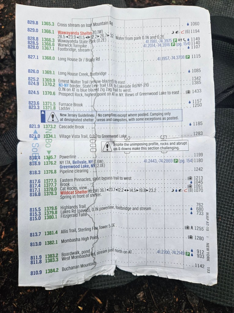
That line in the background is the elevation profile, showing climbs and descents against the numbered scale lines. As you can see, today will be pretty flat, but check out the handy warning below the line marked “Village Vista Trail.” Just because it’s flat doesn’t always mean it’s easy.
The numbers to the left of each line are the distance to the end going Northbound (NOBO) and the distance to the end going Southbound (SOBO). Each shelter (the red names) has a handy row of numbers below it: those are the distances to the three shelters preceding it and following it. To be clear, the guide also indicates established camping areas that aren’t at shelters, though there aren’t any of those on the above page. You’re also, for the most part, allowed to camp anywhere you want, but the established sites are a bit easier, and sticking to those when possible better aligns with Leave No Trace principles.
Each parking area (the green P all the way to the right) has GPS coordinates; often punching those in is by far the easiest way to navigate to these out of the way spots.
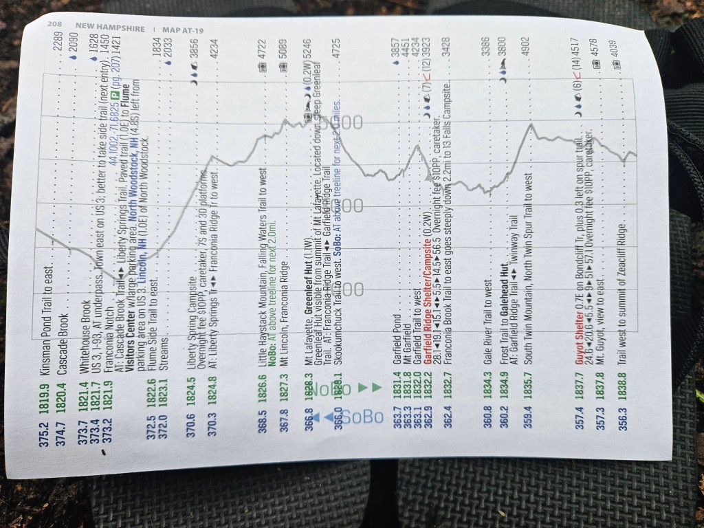
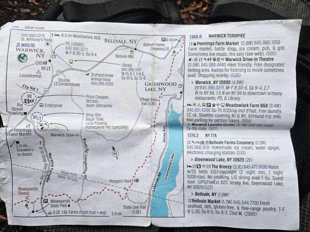
The things we most often look for in the guide are water, shelters and campsites, and towns to resupply in (and once we’re in town, the town maps and blurbs about businesses on the backs of pages are extremely handy). The tidbits about upcoming views, monuments, and other fascinating little things are nice also. Things like this:

Little boxes like that often contain information about plant and flower species you might see on that part of the trail as well, which is always fun to learn. Thanks to David “AWOL” Miller for making such a well-designed guide!
